Communicating Complex Projects Online with Interactive 3D Visualisation
August 2, 2024
Author: Nathan Millar
Introduction
Urban and commercial developers often face significant challenges when it comes to effectively communicating complex project details online. From intricate zoning regulations and traffic engineering to detailed permit requirements and environmental impacts, conveying these elements clearly is crucial for project success. Misunderstandings or lack of clarity can lead to delays, regulatory issues, and missed opportunities. In this article, we’ll explore how interactive 3D visualisation addresses these critical concerns, providing a solution that enhances project communication, stakeholder engagement, and overall decision-making.
1. Navigating Permit Requirements and Approvals
The Complexity of Permitting
Obtaining permits and approvals is a critical and often complex part of the development process. It involves detailed documentation and compliance with various regulations, which can be cumbersome and time-consuming.
Why It’s a Challenge
Traditional methods of presenting permit requirements often involve extensive documentation that can overwhelm reviewers. This process can lead to delays and complicate the approval process, impacting project timelines and costs.
Solution: Our 3D visualisers can present permit requirements and approvals in a more accessible format. By integrating permit-related information directly into the visual model, developers can clearly show how their project meets regulatory requirements. Features such as visual markers help illustrate compliance and streamline the review process.
Benefits: Simplified presentation of permit requirements enhances the efficiency of the approval process, reduces administrative burdens, and helps ensure that all regulatory aspects are addressed.
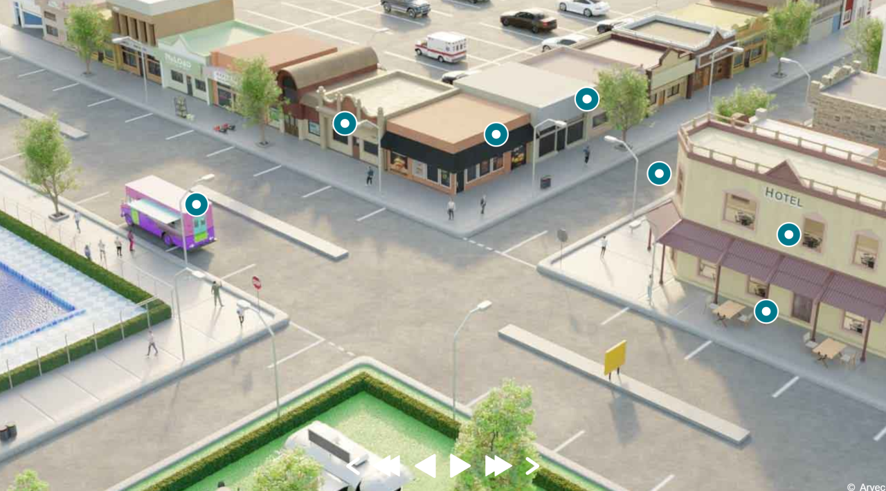
 North Grampians Shire Council’s interactive commercial permit details
2. The Importance of Traffic and Infrastructure Planning
Traffic engineering and infrastructure planning are crucial for urban and commercial projects. Developers must consider how their projects will affect traffic flow, parking, and existing infrastructure. This involves detailed planning and visualisation to predict and mitigate potential impacts.
Why It’s a Challenge
Conveying traffic visualisations and infrastructure changes through static documents or presentations can be ineffective. Stakeholders may struggle to visualise the impact of these changes on the surrounding area, leading to misunderstandings or resistance to the project.
Solution: Our 3D visualisers can incorporate traffic visualisations and infrastructure modifications into the interactive model. By viewing the project from various angles and perspectives, stakeholders can see how traffic patterns will change and how the project integrates with existing infrastructure. Features like interactive overlays could provide a dynamic view of potential impacts and improvements.
Benefits: Enhanced clarity around traffic and infrastructure helps stakeholders make informed decisions, facilitates smoother planning processes, and addresses concerns proactively.
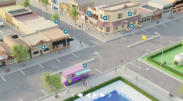
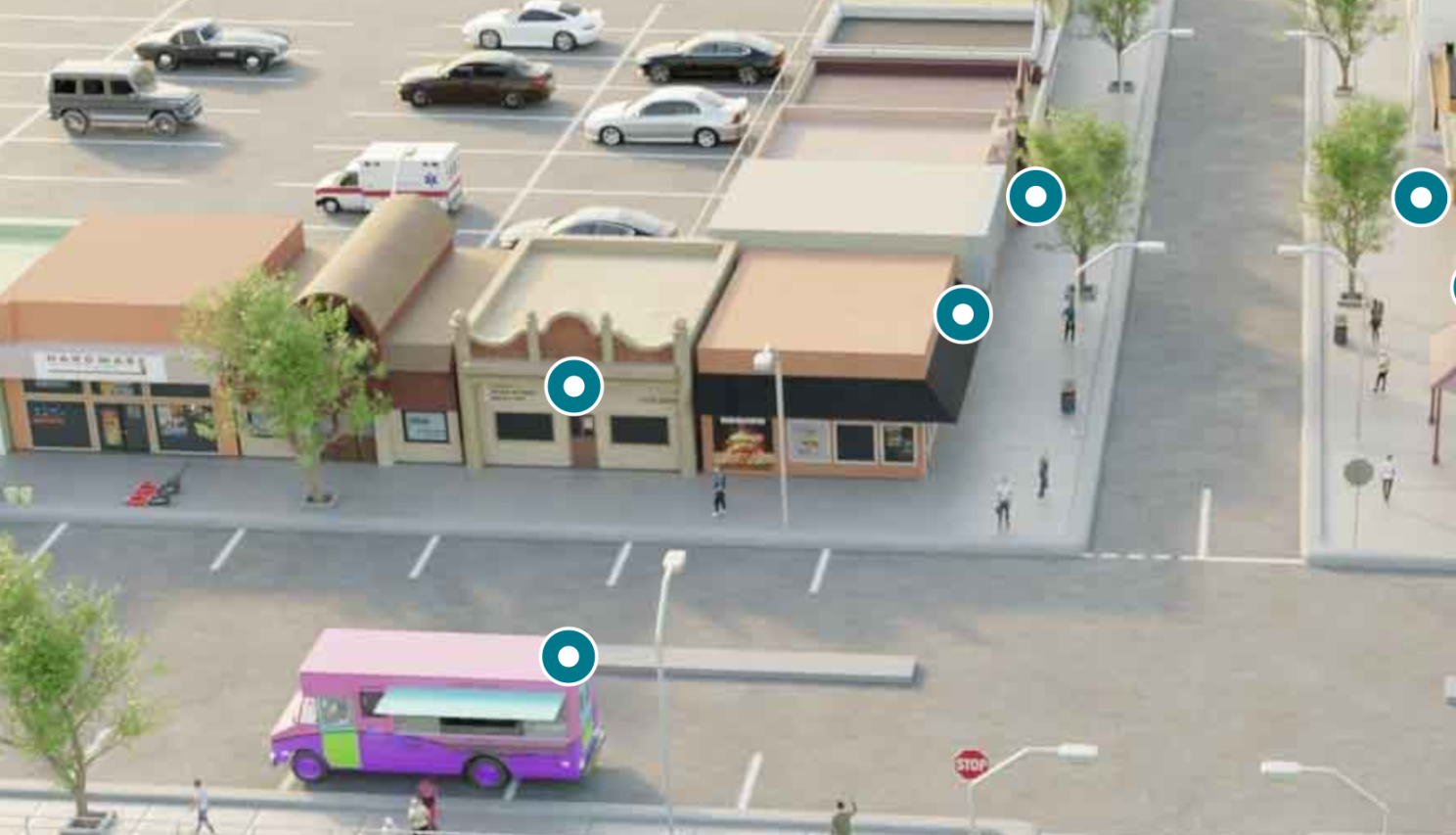 Parking layout and impact on traffic flow
3. The Challenge of Conveying Zoning and Land Use
Understanding Zoning and Land Use
Zoning regulations and land use planning are fundamental aspects of urban development. They dictate how land can be used and what type of buildings or structures can be constructed in specific areas. These regulations are often complex and vary widely depending on location, making them difficult to convey through traditional methods.
Why It’s a Challenge
Traditional documentation and static maps often fail to provide a clear and interactive representation of zoning boundaries and land use designations. This can lead to confusion among stakeholders and regulatory bodies, potentially causing delays in the approval process or misalignment with local regulations.
Solution: Our 3D visualisers can integrate zoning information and land use details directly into the visual model. Interactive annotations can highlight zoning boundaries, land use designations, and their implications for the project. Stakeholders can click on various areas to view detailed information, such as permitted uses and regulatory constraints. This approach simplifies complex zoning regulations, allowing everyone involved to understand how the project aligns with existing regulations and land use plans.
Benefits: Clear communication of zoning and land use helps in obtaining necessary approvals faster, reducing the risk of regulatory issues and ensuring that the project complies with local requirements.
4. Addressing Environmental and Community Impact
The Need for Environmental and Community Considerations
Environmental impact and community engagement are crucial aspects of urban development. Developers need to demonstrate how their projects will affect the environment and benefit the local community.
Why It’s a Challenge
Traditional methods of communicating environmental and community impact often involve detailed reports and static images that may not fully convey the project's effects. This can make it difficult for stakeholders to understand the potential benefits and drawbacks.
Solution: Our 3D visualisers can incorporate environmental data and community feedback directly into the model. Features such as overlaying environmental impact assessments and highlighting community amenities provide a clear view of how the project will impact its surroundings. Interactive elements could allow stakeholders to explore how the project contributes to sustainability and community well-being.
Benefits: Enhanced transparency about environmental and community impacts fosters trust and supports positive relations with stakeholders and the public.
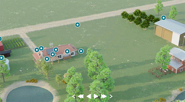 Environmental features visualisation
5. Showcasing Design and Aesthetic Integration
The Importance of Design and Aesthetics
Design and aesthetics play a significant role in urban and commercial development. Developers need to effectively showcase how their projects will look and feel once completed to gain stakeholder approval and public support.
Why It’s a Challenge
Static images and traditional presentations may not adequately convey the design and aesthetic aspects of a project. Stakeholders may struggle to visualise how different design elements integrate with the existing environment.
Solution: Our 3D visualisers provide a realistic, immersive view of the project’s design and aesthetics. Stakeholders can interact with the model to explore various design elements and see how they integrate with the surrounding environment. Features such as realistic textures, lighting effects, and detailed renderings enhance the visualisation experience.
Benefits: Improved visualisation of design and aesthetics helps stakeholders better understand the project’s final appearance, ensuring alignment with expectations and enhancing public support.
Conclusion
Communicating complex project details, including zoning, traffic visualisations, permits, and environmental impacts, presents significant challenges for urban and commercial developers. Interactive 3D visualisation offers a powerful solution by providing immersive, comprehensive models that simplify these aspects and enhance stakeholder understanding. By integrating critical information directly into the visual model, developers can address concerns more effectively and streamline the project approval process.
- Experience the Difference: Discover how our 3D visualisers can transform your project presentations and communication. Visit arvec.com.au to explore our solutions and request a demo.